★☆☆☆☆
No · May 28, 2014 · Strenuous
tigar mountan
★★☆☆☆
jada esser · Oct 4, 2011 · Moderate
i bett it took a whiel to get ther and im gowing in 2 weeks now i know whut expekt wehen i go thanks to you i jaus want to say thank you
Cable Line
★★★★★
Steven Sarff · Jun 19, 2011 · Strenuous
Tiger Mt Cable Line Trail. Ran the flat areas and kept moving on the steep parts. Never took any breaks. After hiking this hike a few times I thought I'd go for a time. 36 Mins 15.2 Seconds. I wanted to break the 35 min goal. Gives me something to aim for. Besides that my average time is right around 50 mins. I just recently hiked this with 50 pounds and was right at an hour. Really is a good hike!
Good Workout
★★★★☆
John · May 18, 2010 · Moderate +
Well, I finally decided to go for it and went all out on the West Tiger Mtn. Trail... and yep... I saw those conflicting signs... it would be deflating if I didn't visit this site first and was expecting it.
And you know what? I haven't hiked anything this steep in 8 years... and I made it to the top in 1 hour.... granted my friend was in fantastic shape and pulled me up...
A word of advice... the last leg before you get to the top is extremely steep... but just keep on going.... the end is closer than you think.
Another piece of advice... bring water and eat something before and during the hike up... you are going to need the extra energy.
Good luck.
Tiger Mountain from Poo Poo point
★★★☆☆
menlokid2000 · Aug 28, 2009 · Moderate
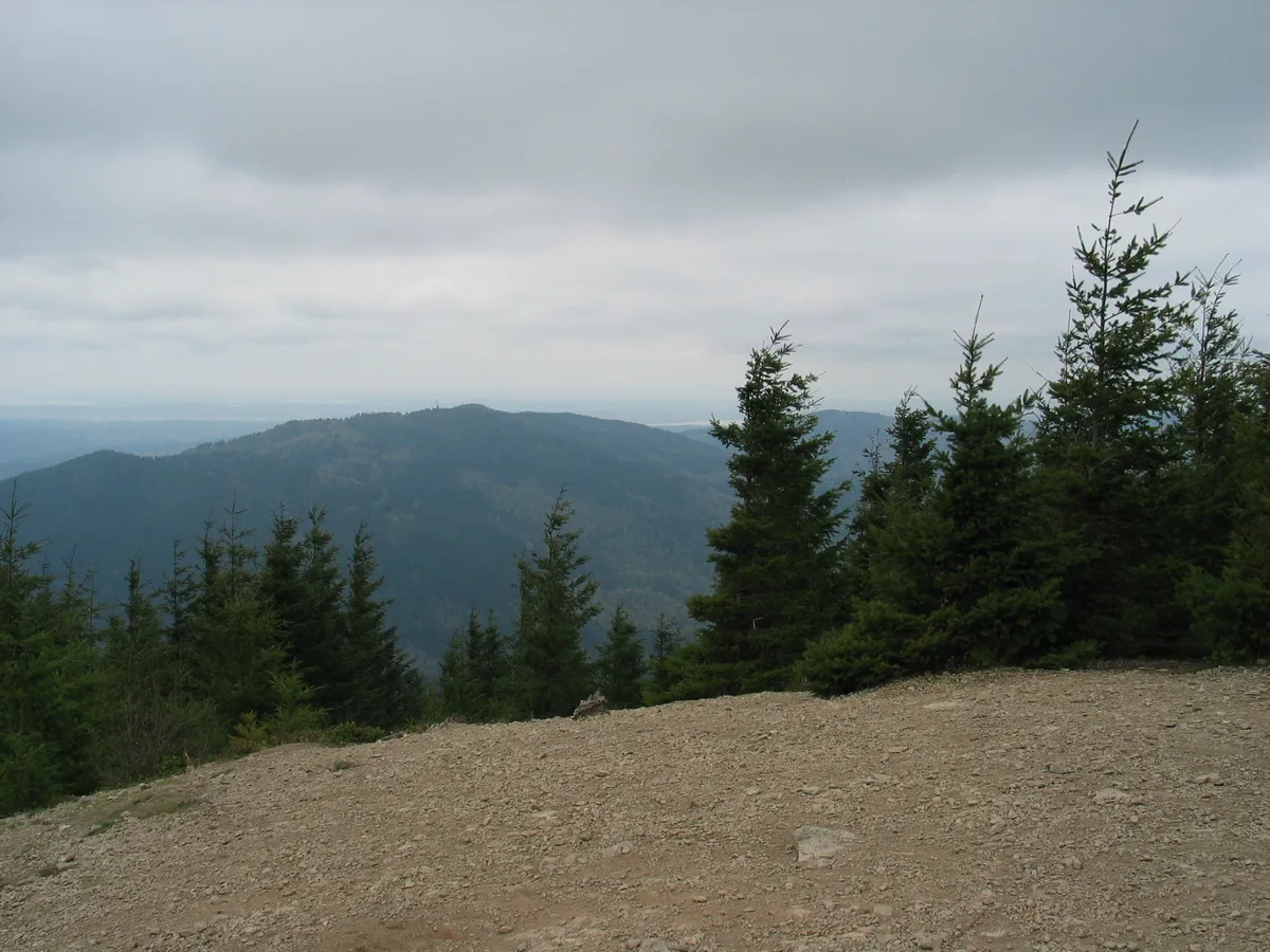
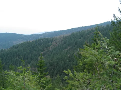
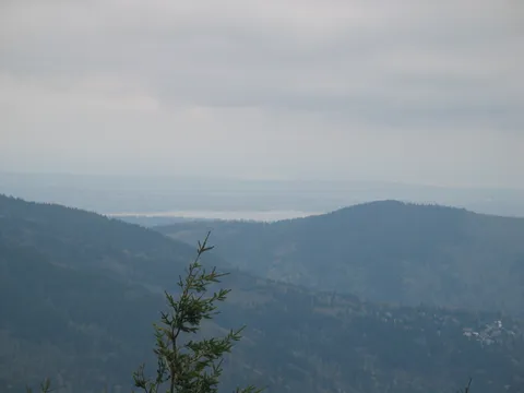
This is a great hike that is pretty close to Seattle / East Side. I prefer this hike from what is known as the Poo Poo point, which really is the Chirico Trailhead. I prefer the Chirico trail to the other one accessed from exit 20 simply because it is less crowded. It takes 2 miles round trip and about 2 hours. The trail is rocky and muddy most of the time, except after mid-way up where it becomes steeper and dry. In about 40 minutes you'll arrive at a clearing that faces south. That is not the real top, but a paragliding launch point. Take the trail that's to the left, going toward north, and after another 5 - 10 minutes you'll get to the larger clearing where there is another paraglider launch site. Nice views of Issaquah and the lake.
You can access this side by taking I-90 East, exit 17, Front street. Go South-East for about 3 miles and you'll see the parking lot next to a grassy field on the left.
NOTE: there used to be plenty of parking on the road, but since 2009 a long stretch of the road has no-parking signs on both sides. You may have to park a few blocks away.
middle tiger trail
★★★★☆
AJ · Aug 27, 2009 · Moderate +
If you really want to get away from the crowds on the trails you need to go much further than West Tiger trails! If you head east from Poo Poo Point you will find many challenging trails of varying lengths. The Middle Tiger Trail is super steep but relatively short; intersects with the Tiger Mt Trail (TMT), and the Hobart RR grade. Beautiful with a variety of forestland depending on elevation. No close public access, so be prepared for a LONG hike just to get to the trailhead. I'm seeing lots of recent trail work as things took a real beating this winter - everything from new bridge to downed trees removed from trail.
West Tiger #3
★★★★☆
Marnie · May 18, 2009 · Moderate +
Hiked this trail this last weekend for something new to try. Drive past it all the time but have never tried it. Saw the sign that indicated 3 miles and thought no problem I can do a 3 mile hike in and out. Didn't realize it was all up hill. Went gung-ho on Saturday only to poop out by the time I got to the top. On Sunday started out a little slower and had a better time gettig to the top. I am not your normal hiker the hikes to site see..I hike for exercise only and I like to get in and get out. I found this trail to have enough challange to it to keep me going not to mention the individuals I saw running up the hill. That was just wrong. Going at a steady pace it was a good 2 hours up and back and I am in ok shape. I can see where it would be easily a 3 hour hike depending on what shape you are in. I will agree with other reveiws that the mile makers need to have some adjustment done to them. It's a little disappointing when you go from 1.6mi to 1.9 mi...makes you think you really aren't getting anywhere.
ok
★☆☆☆☆
fred is dead poor fred · May 17, 2009 · Strenuous
i did it o ya it was the poop like really its kinda cool but not really worth it
West Tiger 3
★★★★☆
Andie · Apr 25, 2009 · Moderate
Great outing. Love that I can bring my pup to the trail. She is an older Golden and we have just started hiking - it was a little much for her running free. Will be more sensitive to her needs next time. Quite steep at times. Recommend poles if you are new like me, or if you aren't, they are nice. Mid April is a great time as there are fewer leaves out yet to block the sun. Will be a very shady hike in summer. Sun only at the top. Loved it.
Tiger Mountain
★★★☆☆
Ashish · Apr 19, 2009 · Moderate
sweet little hike, not hard. just walk all the way up. we just followed the road, some how missed the trail entrance from the road. there were lots of mountain bikers. Also there is a great view of mt. rainier.
http://www.flickr.com/photos/ashishaleti/3457046865/
West Tiger 3
★★★☆☆
angi · Apr 12, 2009 · Moderate
Hiked this yesterday for my second time. First time I did it was about 7 years ago. I have recently lost 120lbs and found it to be much easier this time but still a strenuous hike due to the incline.
It was not nearly as crowded this time of year as it was the last time I hiked it, which was in mid-summer. There were some muddy areas on the trail but not too bad.
The trail is clearly marked but the mile markers are not accurate. You come across a sign that says "1.6 miles" to the top and then after about 10 minutes you see another sign that says it is "1.9 miles". That was a bit of a bummer.
It took about 1.5 hours to go up and about an hour to come back down.
Not a bad hike
★★★☆☆
yonsosa · Jul 30, 2008 · Moderate
I was looking for something close to Seattle that I had never done before, so I hiked up the West Tiger #3 trail. It was a cloudy, misty day and the hike certainly reflected that - a little warm and muggy at the bottom but by the time I got to the summit, it felt chilly. This hike has a relatively strenous elevation gain for such a short distance - it wore me out a bit, but then when I was resting at the top along came an old man who had jogged all the way up. Obviously I felt like a wimp after that. The only other thing I have to add is that I agree that the mileage signs are wildly inaccurate. At one point the signs say you are 1.6 miles from the summit and then you hike for a while and the next sign indicates that you are now 1.9 miles away. I guess life is like that sometimes...
Nice hike
★★★★☆
Balaji · Jul 15, 2008 · Moderate
This is my longer hike so far, and it was great... I'm now motivated to go for longer hikes...
Great Hike!
★★★★☆
Darin · Jul 4, 2008 · Moderate
I thought this was just going to be a great training hike to do for a Mt. Shasta climb I had planned, but found it to be a really beautiful NW forest hike to a great view of the Sammamish area. A fairly strenuous though short climb that took about 45 minutes with a 50lb pack. and heavy double plastic mountaineering boots. I highly recommend this hike to anyone, I've lived and hiked here in the Pacific Northwest all my life and can't believe I've never done it before. Great picnic hike on a summer day and you get to watch all the paragliders! Just do it.
West Tiger 3 / Cable Line
★★★★☆
Anonymous · May 26, 2008 · Moderate
I went up the West Tiger 3 Trail and found it was a fun but challenging ascent. The trail is well kept and fairly wide, and no parts are particularily difficult or steep. However, the trail as a whole elevates fairly quickly and it does start to wear you down. The forest is nice, but there aren't many views, even at the top I couldn't see anything accept more forest (it was a bit cloudy though, and the view of the forest from the summit was pretty nice). Once you reach the open summit area, I suggest you look to your left at the communications tower in the distance. In this direction is a somewhat harder to see (and thinner) path. An extra 10 minutes will take you to the communications tower area (and there's more trails past here that I didn't explore). The path to the tower is even steeper and more narrow, but doesn't take too long and is worth it.
Coming back down, we took the cable line trail which intersects a few times with the West Tiger 3. The signage says that it isn't an official trail and not recommended for most hikers, but it was fairly busy. It is short and steep, difficult to go down (I slipped a couple of times), not maintained, and muddy. But if you want a bit more of a challenge going down the moiuntain, I'd recommend it (you don't need to be a pro, but be aware it is a different style of hiking than the main trail). Some people go up this trail, although I wouldn't recommend this unless you're in great physical condition.
My only major complaint is that the signage is confusing at times: the mileage markers seem off, and at the bottom it can be tough to figure out the various trails (a well made trail map may help). But if you want a fairly challenging, while still somewhat relaxing hike, this is a good place. I hope to try out some of the other trails. I've heard that Poo Poo Point (yes this is the real name) has a great view (although the trail isn't as challenging)
West Tiger Mtn 3
★★★★☆
Dane · May 17, 2008 · Moderate +
As of May 16, the trail was in good condition, a little muddy in places. It was 85 today and the trail seemed muggy. An avid hiker from Montana & Colorado with experience hiking 14'ers and 13'ers and a multitude of other dayhikes and backpacking trips....I rate this as moderate-strenuous. Erring towards strenuous. There are no level spots on the entire trail other than a 1/4 mile or so approaching the trailhead. Do not make the same mistake I did the first time I hiked this trail: Immediately after reaching the trailhead, there is a signed "Tiger Mountain Trail" that veers to the left. It was well-marked and seemed to indicate that was the way (I didn't bring my map or guidebook). It is far more difficult and demoralizing than the Tiger Mtn. 3 route. Steer clear of it unless you have poles and good knees! Anyway, the birds at the summit really do eat out of your hand, I found them to enjoy GORP, but they will also just land on your hand and chill if you are very calm and still. This hike is a great early-midseason workout with a well-maintained, wide path most of the way. The cable line part of the trail is, in my opinion, challenging but boring. Views from the summit are average, you can see the tip of Mt. Rainier on a clear day. Bring a few liters of water and plenty of protein!
Fantastic
★★★★★
JB · May 4, 2008 · Moderate +
It is a fantastic experience for a hike....enjoyed it n memorable experience:)
Not Bad At All
★★★☆☆
Chris · Sep 9, 2007 · Moderate
It was Easy Going up. The First half took us like 30 mintues but then it got steeper and steeper and steeper, and i remember climbing it about 5 years back but i dont remember it being so hard . when we got to the top it was an ok view but many trees blocking the way. I really enjoyed the fact that the birds littarly eat out of your hand., if your going up soon i suggest bringing some crackers and when you hold out your hand and they come down to eat the crackers from your hand! im not kidding it was really cool.but then going down i was expecting some easy walking but it was really hard on my legs. i think it was going downhill which made everybody really sore. i thought it was a fun walk for a beginner for me and i saw some really cool scenes that would be great for photography but i broke my camera the day before the hike.
West Tiger Mtn.3 Trail
★★☆☆☆
Anonymous · May 21, 2007 · Moderate +
We did this hike on 5/19/07 beginning at 11am. Based on online reviews, thought it would be a "easy to moderate" start to hiking season. We were in for a surprise. The incline is much more difficult than expected or from what I read in prior online reviews. Few flat surfaces, mostly just straight up! I saw many people head down before reaching the summit. And, there is a lot of construction going on (lots of park workers on the path.) The scenery is lacking and the summit's view is not very rewarding. We took the "cable line" route back down and that was a mistake for us. Sliding rocks and mud everywhere, not to mention lack of signs to tell you where you are at or how much farther you have to go. (The main path has ample signs.) We missed our turn to the parking lot and had to trek thru gravel pits to get there. This one was a dissapointment for us. And, just want others to be aware that this should not be considered an "easy" hike. The good news is that you can do it in less than 3 hours.
No complaints
★★★☆☆
kenja · Apr 22, 2007 · Moderate
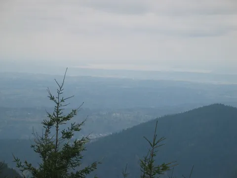
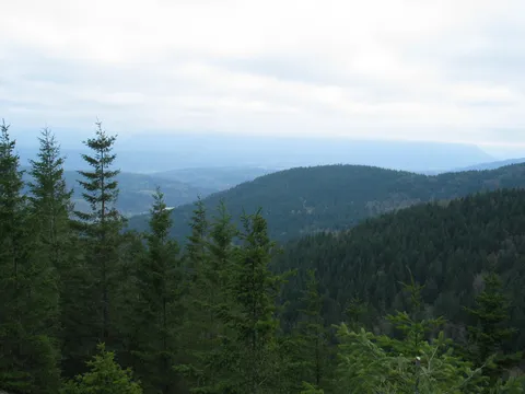
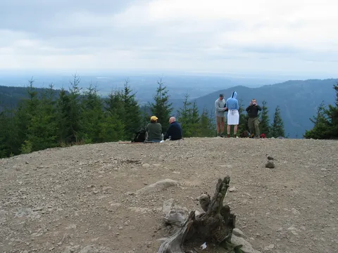
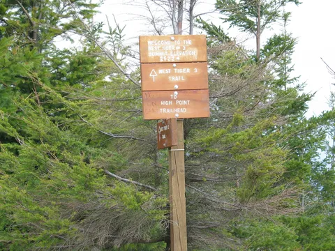
I'd rate this hike a solid 3.5 stars. The access from I-90 couldn't be any easier, the trail is in good condition, and the views are fine. The trail is currently being reconstructed, a sign said there may be delays, but there were none on this Sunday. The sign board mentions restoring the meadow at the summit. Right now, it is bare rock. No complaints from me about the views; the outside world is visible from the trail right now because the deciduous trees have not fully leafed out yet. At the summit, you look down at Squak Mountain, across at part of Lake Washington, and Puget Sound. Looking a bit south of due west, near the horizon you can see the control tower of SeaTac airport. Trilliums are in bloom.
Not quite as many people as I expected for a partly sunny Sunday afternoon (the parking lot was full). As for difficulty, I'd say 2.5 "hikers." This 50 year old is in mild shape--I do a two-mile walk twice a week (uphill return). The only part of the trail that makes you feel like you're climbing a mountain is a short stretch near the top.
west tiger 3
★★★☆☆
mike who hikes · Apr 21, 2007 · Easy +
i found the west tiger 3 trail rather easy but i do a lot of hill and stair walking everyday. i was the only hiker that day who kept my 2 pups on their leashes. would have been great if everyone else had as well. at the top, what a great view. anyone who says otherwise, remember you can't get that view from just anywhere. one hiker was feeding birds right from her hand. i agree w/ the other review who stated the mile postings were not exactly placed accordingly. i did find it frustrating that the map at the trailhead was not the best reference tool.
Where's a massage therapist???
★★★☆☆
Angi · Apr 18, 2007 · Moderate +
Oh my goodness. I am so sore. I don't think I will be able to get out of bed in the morning. After 2 Aleve and an Epsom salt bath, my feet are still weeping. This was a tough hike. Numerous times my 13 year old daughter and I wanted to turn around before making it to the summit. Every person we passed kept telling us how worth it the view is and urged us to continue. It probably took us and our 2 puppies 2.5 to 3 hours just to get up the mountain. Yes, I am definitely out of shape and actually saw people JOGGING up the mountain. I have climbed Granite Mountain before as well, and I have to say, the view at the top of Granite Mountain is SO much better than the view at the top of Tiger Mountain. On the way up Tiger Mountain, we had sun, rain, snow, and hail. When we got to the top, there was a huge grey rain cloud, and much of the "view" was dark clouds. Perhpas the view would have been better if there were no low-lying grey clouds. As of now, I am glad I went. Ask me again in the morning, and I hope my sore, aching muscles will let me keep that opinion.
West Tiger Mtn. 3
★★★☆☆
Courtnie B. on tus. 4/10/07@ 12:00 · Apr 10, 2007 · Moderate +
My family just went on the trial. I am only 12yrs. but I thought it was a great trial! At times it was pretty steep and hard at times , but we finished it at about 3hrs. which was ok for me. It was my first time there. Next we are proble going to go hike mountSi. But we will probly defently come back there!
West tiger Mt. 3
★★★☆☆
Katie Metz · Apr 8, 2007 · Moderate +
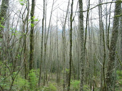
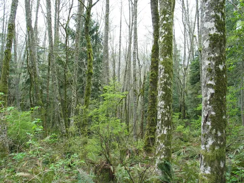
This really is a great starter hike. I moved here from Colorado last year and now live in Seattle. I hiked alot of 14ners and other random mountains there over the years and this hike reminded me so much of Twin Sisters hike by Estes Park near where I lived. I always hiked it as a starter/get back in hiking shape hike, so this Tiger Mountain is great for that and the trees are neat to look at with all the moss and such. Today was Easter so people were setting colored eggs on the trail with little messages on them. It was fun. Anyway, it is nice to have a little hike like this so close to the city where I am living.
West Tiger 3
★★★☆☆
Peter Y · Sep 2, 2005 · Moderate
I've hiked the Tiger Mt. trails a lot and I agree that this is a very popular place. Weekdays are a great time to go.Mileage signs should not be trusted. You'll know when you're at the top, anyway. One sign that is lacking is the one that reads "Parking Lot This Way." If you go hiking at the time of day when you might be descending in darkness, bring a flashlight, or working headlamp. The trails could be treacherous at night. Avoid the trail marked "pipeline route",unless you are in top shape.
West Tiger 3--Power Line Trail
★★☆☆☆
Ryan · Apr 18, 2005 · Easy +
Good starter hike from the season. Not a great hike in terms of views or scenery on the way up, but very close and fairly steep if you take the powerline trail that drives straight up through the regular switchbacks.
Fair Spring Hike If you Don't Mind Crowds
★★☆☆☆
Go4Hike · Apr 10, 2005 · Easy +
Two reviews on this hike in one day pretty much illustrates the fact that this is a busy & high traffic hike!
I chose this hike today partly because it's a close-in snow-free hike and partly because I've often driven past that long line of cars visible from I-90, wondering just what all the fuss was about. As recommended in the orginal review here, we easily found parking in the main lot despite the long line of cars along the road.
We took the Tiger Mountain West 3 trail, the underground cable runs in part parallel to the trail, and seemingly appear to BE parallel trails. Signs advise hikers to stick to the actual trail, but frankly they are so closely situated and intersect so frequently with the trail that the warning seems largely ignored.
A wide variety of hikers use this trail, from trail runners and experienced hikers, to folks in jeans with no water to speak of. We ran into one large group of about 40 hikers who were in training for a Rainier summit this summer.
The hike was not difficult at all though we did take a slow pace (and no, I wasn't wearing a 50 lb. pack, just my daypack.) The views at top were pretty, but not outstanding. On the route down we opted to take a side trip along the Railroad Grade Trail, and found this section to be less traveled and the undergrowth much prettier, if I were to go again I would opt for this section or perhaps the Poo-Poo point area. After about 30 minutes on the Railroad Grade, we returned to Tiger West 3 to return the way we came. The last half mile was a bit like a Highway, there were so many people and so many noisy conversations that it was clear we were back 'in town'.
Try the Three
★★★☆☆
Colin · Apr 10, 2005 · Moderate
I went up the other day took two different hikes to the same Summit 3 Really Bogus. I thought i Had Found another little trail just led me back to where i was. After getting back to the railroad grade i Headed all the way around the mountain to POO Poo Point. If you dont know about poo poo point, it is that little green spot that you can see way above the issuquah high school when you are driving through it on I-5. All of the Hangliders go their it is sweet. if you make it back down to the exit 20 parking lot you have made it along way. YOU ENJOY YOURSELF
Nook to Section Trail
★★☆☆☆
RienMorris · Mar 22, 2005 · Moderate +
Instead of taking the West Tiger 3, My friends and I took the Nook to the Section Trail to the peak. The hike was short in distance but very strenuous and steep.
The trail signs I'm sure were well meaning but were lacking in useful information. About 2/3 into the hike, we had no idea how much farther the peak was. The whole hike is in the woods and the peak wasn't much of a payoff. It's a nice view but you can only see about 180 degrees. I've seen much better views on much less strenuous hikes. Otherwise, it's a good hike for an outdoor workout.
West Tiger Mtn. 3
★★★☆☆
Erik Landahl · Aug 28, 2004 · Moderate +
I do this hike frequently since it is near my home and it is a great short notice workout. I usually carry 50 pounds and get to the summit in just under 1 hour. On a clear day the view of Rainier is awesome and a great reward for slogging through the rocky forested switchbacks.
My concern is that I see difficulty ratings for this hike in guidebooks and on the Web that are all over the place, from Easy to Strenuous. I'd like to clear the confusion and say it is definitely a strenuous hike. Four out of 5 on the strenuous scale.
I carry heavy weights up Si, Bandera, Granite, Mailbox . . . I definitely recognize strenuous hikes. West Tiger 3 may be only 2.5 miles one way but it is definitely a strenuous hike.
So if you're unfamiliar with West Tiger 3, take my word, it is strenuous. Short but strenuous. A note to those reviewers who rate it easy or moderate -- I'll meet you at the trailhead and you can show me just how moderate the climb is. Your choice -- strap 50 pounds on your back, or I'll carry just my Platypus and we can run up the trail. Unless your name is Carlos Buhler or Jon Krakauer, you will not do this hike and think "easy" or "moderate."
Middle Tiger Mountain Summit
★★☆☆☆
Mike Vermeulen · Jul 11, 2004 · Easy +
The Middle Summit is not worth it if you're looking for a good view. The hike itself from the Tiger Mountain Summit parking lot is about 4.5 miles, small elevation gain. The hike is fairly easy except just at the summit. The view there is obstructed by several small trees that appear to have grown in the last few years. Even if the trees were to be removed, the summit only offers a very limited view of the surrounding area.
For the time spent, Poo Poo Point is a much more interesting hike on Tiger Mountain.
Aside from the hike itself there is an interesting historical marker of sorts. On the Middle Summit Trail the trail forks at "Zieg's Zag." The main trail bends back as a switchback. If you continue straight about 0.1 miles you'll come across an old train wreck. This isn't documented on the Green Trail map and well worth checking out.