All uphill
★★★★☆
Milt · Jul 23, 2011 · Strenuous
As of July 2011, you need a state Discover Pass to park at the trailhead. There is only one place in North Bend at the moment to get one and that is at the local Ace Hardware. There is no sign at the parking lot that says "Mailbox Peak", you just have to know it's the right place. It seems that the first mile was somewhat civilizied by a trail crew a while back, but don't let that fool you! It gets steeper, muddier, and then you realize that you are pretty much on your own following reflective diamond markers. If you are not a crazy fitness nut, I HIGHLY suggest that you use trekking poles to keep yourself upright and not face planting on rocks and roots. The trail is a basic scramble up a hillside. You gain altitude with every step. 98% of the trail is on an incline of some sort.
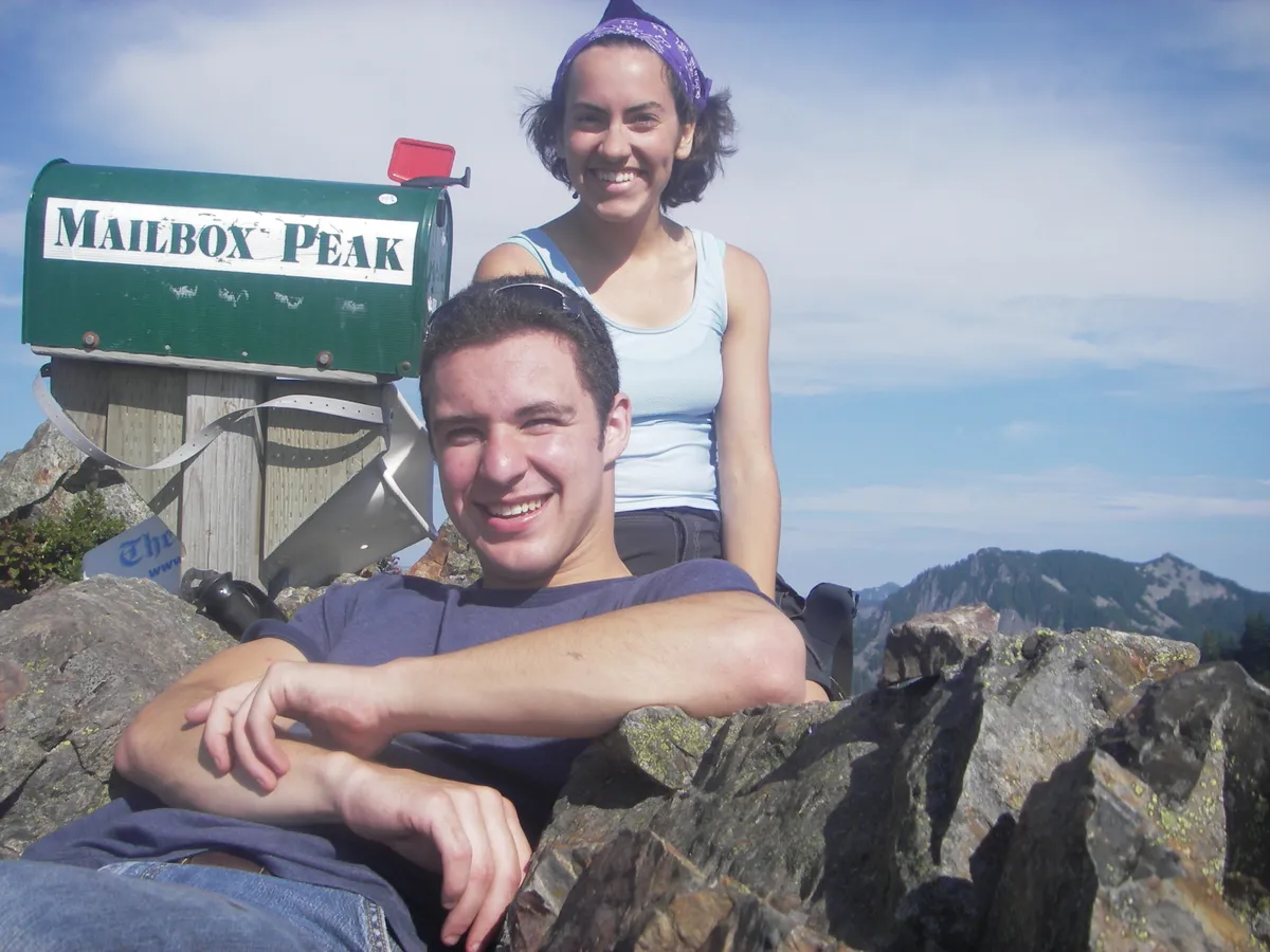
The "rockpile" is your first hint that you are getting close. The trail goes around this obsticle, but it's just as bad as if you were climbing the rockpile. Once you get above the rockpile and out of the trees, you can see the top (if you know where to look). The famous mailbox comes into view anbout 20 yards from the top. Once there, you get a awesome 360 view. Sign the book inside the mailbox, but save the beer stashed inside for someone more needy. Some show-off left a 50 pound weight at the top! I ran into 4 people on the way up and 10 on the way down. It took me 3 hours to get to the top and the same to get down. The trekking pole were a lifesaver on the way down. It kept me from getting muddy & bloody.
Great climb if you are getting ready for Rainier or St. Helens.
It'll take you by surprise
★★★★☆
Corrine · Aug 15, 2010 · Strenuous
Wow! What a hike. I went with a few friends that had done it before, so I was warned, but nothing will prepare you for how steep it actually is. You think it's bad and then it gets worse about half mile in. It was a hot day and I went through two CamelBaks so be sure to bring lots of water if it's going to be warm. Trekking poles are a MUST in my opinion, but there are always good hiking sticks that hikers leave around to use also.
On a clear day in the summer, you'll have no trouble finding the trail, but just no there is no actual "trail" that you have to follow. We blazed our own for a while. There are 2 false summits, and it doesn't really help your motivation, but once you break out of the monotonous trees, you'll be rewarded with gorgeous views of Rainier (that's when you know you're almost there!... sort of) and the surrounding areas. We were able to see all the way to Seattle and Mts Stuart and Baker. It was gorgeous. Definitely worth it.
Watch out coming down though. I'm no experienced hiker but I've done my fair share of treks and this was by far the worst trip down. I was scrambling the whole way. The best way is to skip/hop down and use trees to stop your momentum. That is, unless you really enjoy having your knees and thighs ache and tremble at the bottom. Rinse off in the stream at the bottom too, it's very clean and very refreshing after a long, hot hike! Bring food too, you'll need it!
Challenging
★★★★☆
Anonymous · Jul 23, 2010 · Strenuous
We did Mailbox Peak after work yesterday. Our group was able to meet up at the parking lot by 5 and then we headed up. This was certainly the steepest trail that I have done. With exception to the first 1/4 mile or so, the hike feels like doing the stairmaster at the gym for 2 hours. Constant climbing. As others have said, the wooded area, which you are in for most of the trail, provides little to look at. I'm sure the views at the top would have been amazing, but the cloud cover we ended in was too think to see much more then a couple hundred feet below. I will say though , the wild flowers along the last push on the top of the trail were gorgeous! The mailbox at the top was fun. I was definately glad we brought our doen jacket for the top though..Brr! The decent, was long and steady, and probably the most challenging part...I highly reccommend bring along trekking poles.
2-3ft new snow
★★★☆☆
Abe and Puckett · Apr 1, 2010 · Moderate +
My 18lb terrier and I did this hike early today. Though the incline is a nice workout even for an experienced hiker, I have to admit the trail was a bit boring as peaks go. The first 3700ft or so are in totally enclosed forest without many views. Once you break out it is beautiful with snowfilled views of the Snoqualmie Pass region. This week brough 2-3ft of snow in the area and the trail was snowy 75% of the way.
At the false summit the trail ended. Feet sunk in up to the waist with every step and you risked injury slipping on the boulder field below the snow level.
Good hike for exercise, boring hike most of the way. If going in snow season try not to go after a storm so you won't have to plow your own trail. And pick a CLEAR DAY!
Effort/Reward Ratio...
★★★★☆
Bret Ellis · Jan 6, 2010 · Strenuous
You should have no problem hitting your target heart rate... the first ten minutes of the hike is the only rest you will get until almost the top. After that its straight up for a good hour to two hours depending on the shape you're in. The hike is mostly brutal switchbacks through the woods for the first 3500 ft or so. (There is an elevation gain of over 4000ft in less than 3 miles on this hike). After that you pop out of the woods for a nice view of North Bend looking South down I-90. If its a clear day you might see Issaquah and Seattle too. As you continue on a steady incline you have many chances to look out on a great view of the ridgeline east of I-90 also. Eventually you come to a small trail that strays off to the right and pops out of the woods about 20 ft away at the bottom of a large boulder field. This is the way I took for variety and I'm glad. There is a fairly easy 300 yd scramble (more like boulder hopping) toward the top which is alot of fun. If you stay left and head up you will eventually come right back to the trail. From here its another 800 ft of elevation or so and about 20 min along a clearly defined path to the summit. You will know when you're there because there is a Mailbox at the top that was placed there by Fireman at the end of their climb in full gear with ladders many years ago!! I thought it was tough with just my camelback on!! Overall the views are decent but the hike is very difficult so the effort/reward ration is not a great one. Your reward is feeling good about yourself and knowing you're in better shape than you may have thought :)
A test before the Enchantments
★★★★☆
Dutch · Jul 13, 2009 · Strenuous
Great views up top, well worth sticking it out. Just set a slow steady pace and it's not that bad. If you've hiked the cable line trail on Tiger Mt., just double the distance and you'll have an idea of what you're in for.
I'm hiking the Enchantments via Colchuck then up and over Aasgard so what better way to test the lungs and leg strength than on Mailbox!?
A lot of people I talk to about Mailbox say they only want to hike it once. Now that I've hiked it I don't know why. It's really not that bad... and I'm a 40-year old slightly overweight tech guy. My hiking partner was in a hurry the day we went up so I didn't get a chance to enjoy the peak, so I'll definitely go back up before the snow hits in the fall. Sure, my legs hurt for a couple of days after this one but, again, for a middle-aged dude that's acceptable.
So, get a good night's sleep, have a healthy breakfast, stretch, put your game face on and hit it. Great views await you.
Talk about Steap
★★★★★
Shawn · Jun 12, 2009 · Strenuous
I climbed Mailbox today. Wow, that was steap. The trail starts off easy and very quickly becomes steap. Look for the Diamond markers on the trees they will help you keep you way. There is still a small amount of snow close to the summit, but you only have to walk on snow two or three times for a couple of feet only. Not bad. Don't get discouraged but the false summits. Twice I thought I was comming near the summit. The first is when the landscape changes to smaller vegetation. This is not close to the end. The second is when you finally clear the trees for the second time.... you think you are near the end.... then you turn and see the final push. It took me about 20-25 minutes for the final push, but I was carrying about 60 pounds in my pack. You will know what I mean when you see it. This is the most challenging hike I have done, but well worth it.
★★★★★
Julie · Jun 7, 2009 · Strenuous
I had heard this hike was a thigh burner, and it did not disappoint. There was a very daunting sign at the trailhead warning hikers that search and rescue teams are often called to rescue distressed hikers . After reading this sign, I ventured forward but with a little more trepidation. The hike started out fairly benign, but quickly got steep. The diamond trail-markers were key in making sure we stayed on track, as the trail became less clear. After about 2 hours, we came to a point where we had to make a decision: scramble up the large boulders or hike the steep snow field to get to where the trail continued. We opted for the boulders. The scramble was very do-able. The boulders were large and fairly stable. The last 1/4 mile to the top was the steepest yet and a bit slippery. Finally,the mailbox was within sight! The clouds prevented us from enjoying the view, but we certainly reveled in our accomplishment. Wish I had brought along warmer clothing and gloves for the top. It's COLD!
★★★★★
Anonymous · May 30, 2009 · Strenuous
We left trailhead at around 2.30 pm. Gorgeous day today to hike, and the summit was very pleasant (was comfortable in a t-shirt/shorts up top). No bugs, trail was pretty obvious. At the top there's still snow at the boulderfield.. maybe about 100-200 feet worth, but you could also just hike up the boulderfield or take the trail which goes around (although there's snow there too apparently).. it's slightly muddy for a short bit in that area. No flowers out yet. Ran into a dozen or more people in the 5+ hrs we were up on the mountain. Well worth the effort though.
steep but worth it
★★★★★
Donie · May 17, 2009 · Strenuous
I went up yesterday, still alot of snow at the top but the view is well worth the treck up. A little muddy @ the top but who really cares, its washington. Barley seen any one on the way up and when i did they were coming down. so i got to eat luch on the top alone for arround 45 min. Way better then my second hike of the day up Rattlesnake ledge to east peak. That was super bussy and people are less courteous to people moving faster then they are (your normal fair weatherd campers). All arround a very plesent 72 deg day. perfect for getting out in the woods.
Straight up the Mountain No joke
★★★★☆
Betsie · Feb 7, 2009 · Strenuous
Just got back from this hike about an hour ago, my ass hurts! No sugar coating this one, it is difficult, but of course very rewarding.
Sweet hike, stop yo whinin haha
★★★★★
Vermont Rocks · Nov 20, 2008 · Moderate
Mailbox peak was tough, but my recommendation is just stick with the trail. That rock pile mentioned above is just that... a rock pile, not the trail. Enjoy the hike, yeah it might take some time and gain some elevation, but come prepared, take breaks and enjoy it. The success is in the trying. Peace.
Loved it! (until the next day)
★★★★★
Karen H · Oct 26, 2008 · Strenuous
I climbed Mailbox with a friend in mid-July '08 and broke a sweat very early on, despite the low to average temperatures. I don't know how many times we said, "I knew it was steep, but I didn't know it was THIS steep". The trail is very diverse and is absolutely beautiful at that time of the summer when you come out into a hillside of wild flowers. Climbing up the rock slide was my favorite part of the entire hike, although my friend wasn't as sure of his footing and opted to go up the trail on the left side of the rocks instead. We made the summit in about 2 1/2 hours and the views were amazing! It was very cold and windy at the top though and we stayed long enough only to take in the view, sign the notebook, and have a quick bite to eat. We ran a lot of way down and made it to the bottom in an hour and a half, but I think that was a mistake on our part - the steepness and the pounding on our legs made my quads unbelievably sore for 3 entire days following the hike. I absolutely recommend this hike to anyone who is in good shape but take it easy on the way down!
Tough and beautiful.
★★★★★
Josh H. · Jul 8, 2008 · Strenuous
This is a tough, but rewarding hike, at least if it is done on a clear day. I would imagine that without the views it would be rather thankless. Bring treking sticks. No joke. I don't usually use them, but they were nice here.
Quick walk to the trail head. First few hundred yards easy, past a nice stream. Then its up and up and up. Up is tough, but the trail is very poor quality, so you can't really move that fast. Be careful. I'm a reasonably nibble person in good shape, but I found the decent a bit treacherous, especially the short section in the woods next to the rock slide. Your legs are cold from hanging out on the summit. Lots of slippery roots and rocks hidden in a cake of mud, all at some steep angles. You can be a bit more gung ho in the bottom section.
When the trail opens up at the base of the rock slide, there is a trail to the left that follows its edge, perhaps 50 ft in to the woods. It can be difficult to see, and there were still minor snow fields in some places on July 8th. I ended up going about half way up the rock slide before reconnecting with the trail. The top section to the summit was very beautiful. High mountain prairie, flowers, and amazing views. Like I said, go on a clear day. If you don't this is going to be good for training, and thats about it.
Very hard, pleasing hike. The effort yields a nice reward.
Long Weekend Hike
★★★★★
donbora · Jul 6, 2008 · Strenuous
I did this hike of the 6th of Jul 2008 it was a foggy day and i hoped it would lift in the mountain, it did not :(. There is only a ten yard patch of snow that you have to go over, no problems there. The alpine meadow flower are in full bloom this is good time to do the this hike , flowers in bloom basically no snow.
Good early season conditioner
★★★☆☆
Jennifer · Jun 22, 2008 · Strenuous
This year (2008) it seems mid-June is "early season." In any event, I attempted this with a friend this weekend. We found the part through the woods easier than expected. It is steep, no doubt, but doable. If you can hike Granite Mountain or Mt. Dickerson, you'll have no problem with the forested / ridgeline section of Mailbox Peak. I wouldn't describe it as hazardous and it was very easy to follow the trail, partially because of the reflective trail markings nailed to trees.
We stopped at the large rock pile, near the top. Many people were climbing it, but my legs were shot and the rocks were wet (and slippery) and the snow looked hazardous. Hopefully I'll come back and climb it another day. Because of the last section - the rock pile - I give this hike the most strenuous rating. It was cloudy the day we hiked it, so there were views to speak.
There is still snow covering the majority of hikes, and this one was clear of snow up until the rock pile. It's a good early season hike. In addition, there are no leash laws, so it's a fantastic hike for dogs. There isn't any water after the beginning, so you'll need to bring some for the pooch.
Great Hike!
★★★★★
samspade21 · Jun 12, 2008 · Strenuous
Did this hike just afew days ago (early June). It was amazing. Brought my two dogs and they had a blast going up the steep incline. Careful about the wind once you pass the moraine. It picked up and started snowing on me and the temperature dropped like a rock. I didn't anticipate such cold conditions at the top and it forced me to head back down sooner than I wanted. A pair of gloves would have gone a long way. Also, please note that the other posters are correct - you must have hiking poles to do this hike - do not attempt without! My blog post about the hike: http://www.bdfamily.com/2008/06/mailbox-peak-hike.html
Mailbox Peak For Rehab
★★★★☆
Anonymous · Jun 7, 2008 · Moderate +
I hiked Mailbox Peak on May 30, 2008.
First I will say, this hike is very much worth it. When I started at 1200 it was overcast and cool. By the time I reached the top at around 1415 it was a beautiful sunny day with the temperature at the top perfectly cool and crisp. The views were great and the mailbox contents made for an interesting goal.
I did mailbox peak as rehab for a neck injury I recently sustained and had surgery to correct. The hike on the way up delivered just that. Once you start there are no easy stretches more than about ten feet in length. I felt the way down was a tedious decent where I spent more time trying not to fall than enjoying myself or exercising. Although I did find the first (and last) third of the hike (after the warning sign) to be the least difficult, if for no other reason than the trail is well defined here.
The Hike
Treed portion: This portion of the hike you are simply doing your best to follow the trail. There is absolutely nothing worth seeing here. It is all dark forest of varying density. While the trail here is difficult, it does not allow for a fast pace and thus is more of a strength and balance test than cardiovasucular. For this reason you can hike straight through without having to stop to catch your breath.
Upper Clearing: Although the hike does not get any less difficult once you leave the treed portion, I found it to be easier to stomach as I felt as though I was finally getting somewhere. You also face a variety of obsticules here, making things more interesting. First (when I went) you have a choice between climbing snow or a rock slide. On the way up I chose the rock slide as I felt it would be more challenging and a bit safer. Second you find a small winding dirt trail that takes you to the peak. Again pretty straight forward on the way up.
Peak: The peak was unbelievable. As mentioned above, by the time I reached the peak it was perfect weather. It has plenty of area to sit, eat lunch, and read the mail. I left here at 1515.
Down: I found the down portion to be by far the most difficult. Since the sun had been shining on the top, the dirt trail was baked dry and thus was very slippery. On the way down I attempted the snow next to the rock slide I had chosen on the way up. It only took me about five feet to realized I could not stand well enough to feel safe decending. By this time the sun had made the snow very slippery. I retreated back to the rockslide where I again had an easier time. Through the trees, the damp soil that had made traction easy on the way up was slippery under the jarring weight going down. This was made worse by my still recovering neck. I made it down at 1700 ... so five hours total.
Things To Note
I did this hike alone. I would not recommend this as there are many sections that have a high likelyhood of injury.
Wear appropriate gear. Hiking shoes/boots with traction. Water. A phone is a must (since you are over I-90 you should get reception in places)
Go at an appropriate time. The possibility of getting lost in the daylight seems pretty high. Thus nighttime would be nearly impossible.
I was supprised how many other hikers I saw. I did this hike on a Friday and saw around 20 other hikers.
Capital 'B' Route - Beautiful & Brutal
★★★★★
H2OBoy · May 26, 2008 · Strenuous
Pinchy the Hobbit and I did Mailbox Peak on Sunday May 25th...
We left the trailhead at about 7:00am and made the peak by 11:00. My advice to anyone thinking of doing this route is to read the warning sign at the trailhead and take it seriously! Trailhead altitude: 868ft.Bring lots of water! There is no water available once you've past the small creek!
It is a beautiful and rewarding hike... I'll do it again anytime. Dragging novice hikers, kids, dogs or friends who aren't really into it is pure folly.
This trail starts with a walk up the road to the trailhead. It then moves through a nice forested section. These are by far the easiest stretches on this trail!The trail then begins, almost immediately, to switch back. The switchbacks start between 950 and 1000ft and continue to about 4100ft. We encountered snow at 3600ft, but it was easily passible all the way to the top. When you come out of the trees and see the moraine you'll want to stay to the left. This moraine is extremely treacherous and unstable... head back to the left and ascend around the moraine. Once you've topped this section a small, winding, steep traip moves up the ledge to the mailbox.
The views you'll get from the top are worth the punishment you'll endure to see them.
This trail is NO JOKE... it is steep and tight enough that my GPS had us stopped for longer than it had us moving... we never stopped on the trail.
If you go, have fun, a positive attitude is a must on this hike! Some pictures can be found at www.flickr.com/H2OBoy007.
Mailbox is a great first taste of touch hiking
★★★★★
Zach M · May 20, 2008 · Moderate +
Well as an old East Coast boy , I never got many mid May snow capped day hikes before. Mailbox Peak is steep, Mailbox Peak is difficult, but Mailbox Peak is worth every step. May 17th, was a blazing 90 degree day and we started at 2:00pm. The first two-thirds of the trail is nice and shady and it cools down as we climbed higher and higher. Also, the snow-pack at around 3,000 kept us nice and cool. Bring about two liters of water per person, the only water source is a stream right after the trailhead, and on the trek down is a real sight for sore eyes. A walking stick is a must on this trail and makes traversing the snow possible. There are not many vistas until you reach 3,000 ft and you think you are going to summit several times before you actually do. When you do reach the peak, the 360' view is just outstanding. Our day was crystal clear, and the view of his majesty, Mt. Rainier was breath taking. Boy howdy, the trek down was fast, but you will feel it in you feet, quads, knees and core. The descent down the snow pack was a blast. We skied it on our boots, using our walking sticks to control speed and direction. It was pretty empty on the trail. Maybe a dozen hikers going down and we climbed The trek down takes maybe an hour and a half. I didn't feel to bad the next day, but I did feel it two days post hike. Dude, get out there and hike it. It is an enlightening trek.
★★★★★
Anonymous · Mar 2, 2008 · Strenuous
I went there in early march. The early part was much harder than i had thought(or maybe i have to get back in shape after winter)
There was snow&ice for about half of the trail. It was a sunny day and the view was spectacular
I was in tennis shoes and coming down was murder !! I Must have slipped atleast 10 times
just do it
★★★★☆
ST · Sep 21, 2007 · Moderate +
I was kinda scared to do this one after looking at people's reviews consistently giving this one 4-5 difficulty level, but it was a blast! If you're in decent shape do not be afraid to take this hike. Even though it's steep, the elevation is even and it's not like you have to crawl on your four at any point of the hike. I went a few days ago and the trail was wet after the rains, so at a few spots you'd have to watch out for slips, otyher than that very doable.
The view must be great at the top, but it was cloudy, so I didn't see it.
Not for the faint of heart!
★★★★☆
Tracy and Chuck · Aug 14, 2007 · Moderate +
We are oldtimers - almost 50 and have done a lot of hiking in the PNW. Bandera was tough, but this is a much greater challenge. Going up was 2 hours 15 minutes; down much faster at 1 hour 30 minutes (we were cruising!) It was definitely worth it - the view was spectacular, and we encountered only one other hiker en route. Bugs and flies at the top were unrelenting, which was disappointing - all we wanted was 15 minutes to rest and savor the view. But it was one of those hikes when back home, with a cold beer, you look back and are really glad you did it. Go for it!
Mailbox Peak in July
★★★★☆
Susan S · Jul 8, 2007 · Strenuous
The Sunday Peak bagging crew (including my boyfriend, a friend of his, and me) had laid its sights on Mailbox and could not be convinced otherwise. Bandera had been done by all of us, those who aren't me had done Granite, and I'd done Defiance on the same day as my second ascent of Bandera. I'd heard from the more hardcore types that Mailbox was beyond the difficulty of McClellen Butte, which I did last summer and it inflicted pain then, but somehow it seemed like a good idea on a mostly sunny Sunday morning. I was still feeling somewhat cocky from the two peak day a couple weeks previously.
After some horrid misunderstandings of the guidebook on the location of the trailhead and some dirt road wanderings we started up at about 10:30. The first bit of old road lulled us into a false sense of security. Pretty, green, nice smelling. Yeah, not too bad... And then it started. Through the deep dark forest. Pulling ourselves up along trees and stopping for emergency cheese. In all obnoxious honesty, I wouldn't have stopped as much as we did if it had been my pace, but at the same time, I'm good at pushing myself to the point of suffering, and the frequent water breaks were a good idea. We lost the trail here and there, took shortcuts thinking they were the main trail, and then took the trail to the left at a painted marking. That took us all kinds of hither and yon, but we eventually met up with the actual "trail". We passed a line of trees each with an orange paint spot and after the type of eternity that can only exist on a very steep hike, found our way out of the forest. And then there were the wildflowers. And the sun. And it was all somehow worth it. Even though the trail continues in its unbelievable steepness, it feels more bearable when there are tigerlillies, lupins, red flowers, blue flowers, white flowers, almost-blueberries, and chirping birds. We opted to scamper over the rock slide, reporting the less stable rocks to each other. The last bit up to the peak was steep but exhilarating. It took us 2 and a half hours up. Pictures were snapped, the remainder of the cheese was consumed, a quick nap was taken by one member of the party, and the other two of us wandered a little bit along the ridge. Spent about 45 minutes at the top. The boyfriend and I opted to not run back down, but the napper seemed refreshed and mostly wanted to get away from the mountain quickly. We avoided the rock slide and found the trail much more easily. Toes were smashed together and mosquitos bit, but we got down in about 2 hours. The runner took only about one.
We all hurt. A lot. And I believe it was worth it. I enjoyed it for the most part, though other people were less enthused, and it was agreed that it won't be done again for quite some time.
Steep and muddy
★★★☆☆
VictorM · May 13, 2007 · Moderate +
We started the hike in quite a good weather. And with a hope to reach the top. We had to turn back a bit higher then a snow level. Snow melting on the trees make a strong rain even though overall weather is quite good. It makes a LOT of mud on the road and pretty cold shower. I had my 2-years old son in the back seat and he did not appreciate the rain at all. And forced us to go back...
Overall this is really funny hike, assuming you can call "fun" really steep and muddy trail. Indeed, I think this is a steepest trail I have ever made around I-90.
View from the trail is not too diverse. Pretty much all the time in the deep forest without any outlooks on the way. I guess we would have better picture if made it to the top. But still, on the way up you can only enjoy the forest itself (which is not that bad and quite worth enjoynment). In any case, now, May 13, the trail is still not very ready for family hikes. I hope it will be in better condition in about a month. I'll give it another try then.
Great in the spring
★★★★★
Anonymous · Apr 28, 2007 · Strenuous
We hiked Mailbox Peak on 3/25 and a month later on 4/28. In March, the upper section beyond the forest was covered in deep snow and views at the top were obscured by clouds or fog. Today, the snow is almost entirely melted aside from a few patches, but the trail is quite muddy and slippery in places. It's still as hard as ever, but the views at the top were finally clear and beautiful. Don't bother with this one if you don't enjoy difficult hikes - half the fun here is being completely exhausted at the end.
Tips for newcomers: Do skip the rock field (bypass on the left) if you're not specifically looking to climb up rocks as the top is much further up than it looks! There are two points (at the base of the rock field and again further up) where it looks like you're about to summit, but you actually have several hundred extra yards to go, so don't despair and don't think it's the final stretch unless you can actually see the mailbox. Don't be surprised if you slip and fall in the mud several times. When lost in the winding and splitting trails in the middle forest section, the best choice is usually the left route. If you find yourself off trail, don't panic, just keep moving up and you'll meet up with the real trail eventually. On the way down, orange dots on trees mark the trail very clearly.
No Stamp of Approval for Mailbox
★★★☆☆
Gail Chiarello · Oct 28, 2006 · Strenuous
Alan Singer and I hiked Mailbox on Thursday October 5, 2006. We set out from the trailhead at 11:15AM. The way up proved to be an upper body workout as well as a quads/buns work-out. It was so steep we found ourselves grabbing slender saplings along the way, literally hauling ourselves up the trail with our arms.
We tackled the rock pile believing that the famous mailboxes were located at the top, but when we had summited the rock pile, there were absolutely no mailboxes. By now it was 2:38PM, so our hiking time up was 3 hours and 23 minutes. In the distance was a ridge with a smaller rock pile on its flank--presumably that was the location of the mailboxes-- but we were beat, and wanted to eat our lunch. We began our descent at 3PM in order not to be hiking this very steep trail--filled with tree roots--in the twilight. Glancing down the rock pile, we saw air in all directions. It was clear it had been easier to climb up this scree than to descend back down it. So we located the rough path north of the rock pile and began our descent.
I disagree with other reviewers of this hike, most especially, “Tallteleboarder,” who wrote in his October 1, 2006 review, “I think it would be hard to hike and not summit in less than 2 hours and 30 minutes.” We were close to one hour more than that. Tallteleboarder also reported he and his wife took 2 hours and 10 minutes to descend. Our return took us just under 3 hours … we arrived at our vehicle about 5:55PM.
Karen Sykes in an old November 27, 1997 “Hike of the Week” in the Seattle PI wrote, “If you don’t like the rock slide, you can bypass it on the left … but personally I prefer playing on the rocks.” In retrospect, “playing on the rocks” cost us quite a bit of time and was possibly dangerous for somewhat older hikers without great balance and sure-footedness.
We are in our mid-sixties and have good stamina. We have done Mount Si and other hikes over 3000 feet. However climbing almost 4000 feet in 3 miles was hard, and the descent was murderously steep. We were lurching from tree to tree to arrest our pace. By the time I was two-thirds of the way down I had “sewing machine legs” (they were trembling rapidly up and down) and only a stop to gather four white chanterelles provided any relief.
I would warn hikers thinking of doing this hike to be sure to have climbed Mount Si recently (as a test of your fitness), to get an early start, and to avoid “playing on the rocks” unless you have as much experience and confidence as Karen Sykes. I have since read several more reviews of Mailbox and the general consensus is to allow over three hours for the ascent and an equal time for the descent, because of its murderous steep slope. Once you're on top you have fabulous views of I-90 below plus all the roar of the semis crawling toward Snoqualmie Pass. I'd say Mailbox is a bit overrated ...
Them’s my thoughts.
★★★★★
Tallteleboarder · Oct 1, 2006 · Strenuous
This is a great hike. I rated it stenuous because the hike is uphill the whole time at a good pitch too. There isn't any scary sections or scrambles that would warrent people not doing this hike because of the strenuous rating. Anyone can do it but it is uphill. My wife a I are not super hikers but we do hike, putting one foot in front of the other and not stopping. We summitted in 2hrs and 20 minutes. I think it would be hard to hike and not summit in less the 2hrs and 30 minutes. I took us 2hrs and 10mins to get back down. There were great views and the summit had two mailboxes with lots of interesting stuff. There is a log book which we signed, there was a newpaper (a little outdated so bring something more timely and switch it if you can), there was some fake poo, and lots of other little notes. Definatly recommend the hike. The trail head is about ten minutes up the logging road. You will know you are getting close by the little brooke. The trail takes a left before going over the brooke. The hillside is covered by switchbacks which makes the hike interesting. If you are feeling energetic you can take the more direct root and if not traveling the switchbacks will work too. There is no wrong way and when the trail starts to look sparcly traveled you meet up with another better traveled one. It was a lots of fun and highly recommeneded.
Have a great hike!
great conditioning hike
★★★★★
naveen · Aug 21, 2006 · Strenuous
pretty strenous hike, though a short one in length. Took 2.5 hrs to get up and 1.5 hrs to get down. Not too crowded. Part of it does not have clear trail. Highly recommended.
Mailbox in May
★★★★☆
Charlie · May 26, 2006 · Moderate +
I'm a fan, this is a great conditioning hike...
- Close to Seattle
- Burly
- Not very crowded
Me and Holly made it to the boulder field, relaxed and decided to skip the last leg. I'll be back
The Dragon Alien Festival checks out Mailbox
★★★☆☆
DAF crew · Oct 16, 2005 · Moderate +
We set out on this hike expecting a challenge, and a challenge we got. According to the altimiter that we brought the hike gains about 3,900 ft from the parking lot to the top. The trail is pretty steep most of the way with the exception of the first leg on the logging road and the first few hundred feet through the forest. One needs to take care to keep on the trail, it proves ellusive at points. It seems there are multiple small trails leading off of the main trail. One way to keep on the main trail is to keep an eye out for the yellow-spray painted trees that seem to mark the most traveled path. The trail, is also not maintained that well. Watch out for loose roots, loose material on trail. The trail mostly travels through a young forest, but there are boulder fields, and some viewpoints near the top. On the particular day that we went up there were limited views due to clouds. We could only see to the South, never to the north.
We hit the trail at about 8:15 and summited 100 minutes later. This was at a vigorous pace for a couple of pretty fit young people. This counts some time to find the trail again after losing track of it. The four hiker rating is mostly due to the physical exertion required to climb up, but finding the trail is another factor in this consideration. The 3 star rating is mostly due to the monotony of scenery, and the fact that we didn't get great views. Watch for the haunted forest. Not too much in the way of wildlife sightings either.
This was a reasonably enjoyable hike that is a bit of a workout, recommended to people looking for such.
Short and brutal, kind of like my girlfriend
★★★★☆
D. Hoser · Oct 11, 2005 · Moderate +
This is one of those hikes that beats you down every time, but somehow, you always end up coming back for more. By my count, the trail is actually closer to 6 miles round trip rather than the listed 7.5, but don't consider that a blessing. You still have to deal with that 4,000 foot climb. Making matters worse, the first 1/2 mile or so is fairly flat, so you're climbing at a rate of 1500 feet per mile for the part that counts. Yeeouch! The trail itself is very rooty, with many of the roots running parallel to the trail and guaranteeing an upending on the way down when damp. Several 'short' cuts have been improvised by fellow hikers, but none of them are really any shorter or easier than the main trail. It's a rough, steep, thigh-burning and knee-jarring trail, and I loved every minute of it - it's definitely become one of my 'comfort' hikes (ha!).
Overall, Mailbox is a great hike for people who take delight in abusing their bodies. The views from the top are great; the notes crammed into the two mailboxes range from hilarious to self-important to obscene, and are worth a chuckle at the very least. Expect to spend roughly 4 hours from car to car if you are in decent hiking shape (we took a shade over 2 hours up, 0:45 at the top, and about 1:20 down). Do NOT take hiking neophytes or out-of-shape relatives on this one; they won't ever want to go hiking with you again. Even if you consider yourself in great hiking shape, plan to spend the ensuing day or two with an aching rear end and stiff quads, but who cares. Just go!
Unpredictable
★★★★☆
Doug and Einstein · Sep 10, 2005 · Strenuous
I started this trail in fairly miserable conditions. It was raining steady as I left the car. I managed to enter the trail at the wromg spot, but as has been mentioned previously, this is not quite a trail route, but more a scramble and search. Toomany people have taken shortcuts across the switchbacks and it can be confusing at times. I noticed that for much of the trail, someone has cut blazes into the tree bark so they can help. It doesn't seem to matter which way you turn, all roads lead to Rome (or at least to the mail box). Once you climb to the Fern meadow, at about 3500" there is only one road. Once through this, do not be tempted to climb the scree slope, it is not the summit, but contimue left around it. You will climb around the boulder field and upto a ridge where the trees end. Keep in mind that on the ridge you are quite exposed to the elements so be prepared today as I left the trees, the rain became sleet and the wind was quite cold on my now drenched attire. The summit views are cool. Going down is treacherous. Be very careful if conditions are muddy, it is steep enough to slip and ruin a perfectly good femur.
Rugged but Good
★★★★★
Bill Fulton · Sep 4, 2005 · Strenuous
I left a little late on Saturday as I got to the trailhead at noon. I was alittle wary about this hike as I had heard first hand reports about its toughness. All reports were correct. I took my time and got to the top after 2 hours and 40 minutes. Like the original review states, keep left and always take the high road and you will not miss the correct trail. Just when you think you should reach the break in the tree line you will have awhile more to go. But once you break the tree line it is just a short stint to the top. You won't be able to see the mailbox until you are almost on it. I had a great day of it. I met Jack and Tim who were taining for Mt. Whitney in Califormia. 2:40 Up 2:00 Down. -Bill
Mailbox Peak in the summer
★★★★★
Amy M · Aug 15, 2005 · Strenuous
August 13th was the first time I hiked up Mailbox. Steller's jays (Cyanocitta Stelleri) were common in the trees along the gravel trail. At the end of the gravel trail, I took a left towards an unmarked trail, I wasn't exactly sure if I was on the right trail to Mailbox Peak. Parts of the trail were hard to follow in the fallen down trees and branches. Since the trail was very dry and dark, finding foot traffic was hard. Along the way, I came upon three men, resting under some trees on the trail; they asked me if I was going to the mailbox; that was when I knew I was on the right trail. Further in the dense forest and steep trail, I stopped to watch a woodpecker at work...a great way to take a few minutes break from the continuous uphill. At an opening through the trail, I saw a cairn on a rock; I decided to take that route. Less than half of a mile away from the mailbox, I stopped to take pictures of the beautiful wildflowers in the sun (may have captured some hummingbirds, though they were pretty fast) and the views of the nearby peaks, valleys, and I-90. The view from the summit was great. Mt. Rainier was partially covered in clouds, but still a sight to see. Though it was steep, I ran and slid down (which I would not recommend to anyone) to avoid using my headlamp, I got to my car in 1 hour and 15 minutes. I would highly recommend Mailbox. Don’t forget to sign in at the peak.
Mailbox Peak is steep!
★★★★☆
Ather · Aug 13, 2005 · Moderate +
I went hiking up Mailbox Peak with a few teammates yesterday. I had a feeling this would be tough but I wasn't expecting it to be so steep. This hike is definitely not for occasional hikers. It took me 2 hours to get up there and as much to come down - Coming down is hard, specially if your boots are old '- the loose dirt doesn't provide a lot of traction.
There's a great view of Mt. Rainier from the top. Besides that, the trail isn't quite clean and straight forward. Lot's of dead tree roots in the way so you have to be careful. A pretty good hike overall - I'll definitely go again - but not the day after I go playing squash!
As described...
★★★★★
bill · Jul 7, 2005 · Strenuous
7/7/05 - The trail now seems to have a home made trail head marker so you don't need to guess too much about where to start.
Firstly I am not a seasoned hiker. I starting hiking in the summer last year as an alternative to going to the gym that allows me to walk the dog! My attitude is changing though and I really do enjoy some of the hikes I'm doing. I found this trail hard going once I left the stream. I reminded me of the old Si trail (which I did on earlier in the week) - a toe only trail for much of it in that my heal doesn't touch the ground first. More relentless than the old Si trail though and went longer. I was 2 1/2 up 1 1/5 down and I kept a good pace going.
The view from the top was good, but not as good as Mt Si - Mt Si is in the way! This is a hike that I'll do again but not next week! It kicked my a**.
Mailbox Peak in the spring
★★★★☆
Mark W · Jun 13, 2005 · Moderate +
My wife and I have made the climb several times this spring as an alternative to Mt. Si as a conditioning hike. There is very little comparison between the two. Mailbox is steep, lightly built (trailwise) and relatively lightly used.
Our hike last weekend was rainy, wet, muddy, and snowy at the top. We were the first to the top but there was a steady stream of hikers on the way up as we were coming down.
It was a messy climb. If it is wet, I would recommend boots that that will keep your feet dry when buried up to your ankles in mud and gardening gloves for the likely slips.
It was fun for us but had to be less pleasant for the people at the end of the day because the trail was torn up.
One of our trail neighbors mentioned that Mailbox Peak is on the list for trail rebuild. While it will make it more durable for bigger crowds, it will take away some of the charm of a semi marked trail hike.
We both recommend it.