
Mt. Pugh

5.0 out of 5, (5) Mt. Baker National Forest-Snoqualmie, WA Strenuous 1 trip report · 15 photos
Round trip
11 mi
Elevation gain
5,400 ft
High point
7,201 ft
Difficulty
Strenuous
Season
Jul – Nov
Pass
None
Dogs
Allowed usually
Trip report

October 14, 2006

Strenuous 9 hours Verdict: Great
★★★★★ 5.0 out of 5 from 5 votes · log in to vote

Directions:   I-5 North to Exit 208, drive East towards Darrington, WA on Highway 530.  Once in Darrington, you'll turn right onto the Mountain Loop Highway (odometer zero).  At about 9.5 miles, the road turns to gravel.  At 13.2 miles, you'll see FR 2095 on the left.  Turn here.  At 14.7 miles, there'll be a switchback with the trailhead on upper side to the right.  Park below the switchback.  You're there!  Note: since the bridge is out on the Mountain Loop Highway, you'll have to go up to Darrington rather than approach from the South through Granite Falls.

Trail Notes: I did this hike last October and having seen that is only mentioned in passing on this site, I thought I'd post a review.  I'd recommend getting an early start on this one as it will likely eat up most of your day and there are some great views at the top which you'll likely spend some time admiring.  Also, this is a day hike and there aren't many places to pitch a tent.  Bring plenty of water if its a hot day as you'll be exposed to the sun.

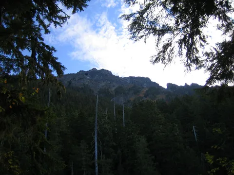
There was a notice at the trailhead requesting any reports of mountain goat sightings, but sadly we did not see any.  You'll begin with a leisurely pace amongst some alders and mixed growth for the first mile or so until you encounter the first switchback and the incline increases.  Here the forest is thick and evergreen.  You won't get a glimpse of your destination until about two miles where you'll run into Lake Metan which is somewhat murky and not exactly inviting.  This may be a possible camp location, but I cannot recall how flat the ground was here.  Looking up you'll see the ridge through the trees.  This makes a good place to take a quick rest and a light snack since the trail will get steeper from here on out.

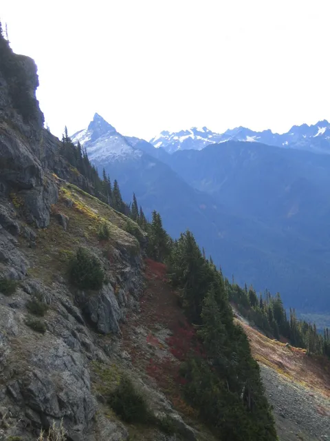
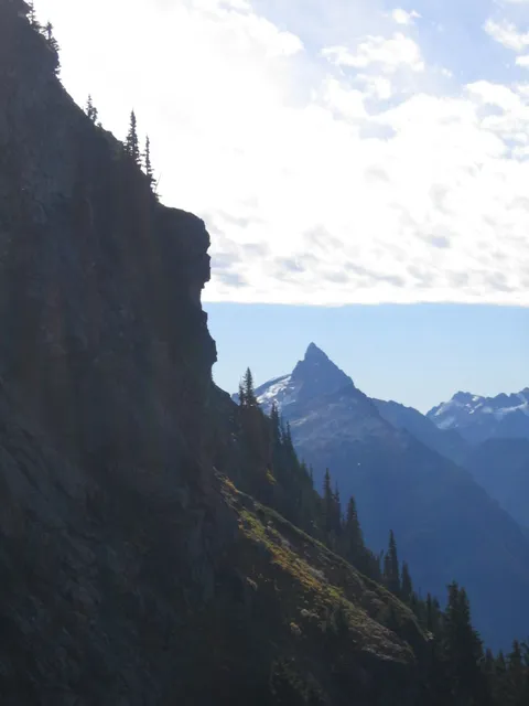
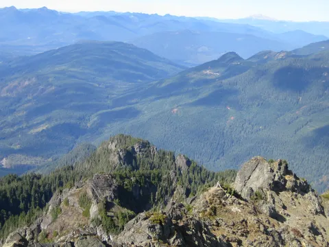
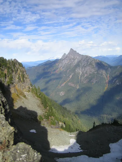
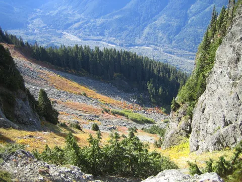
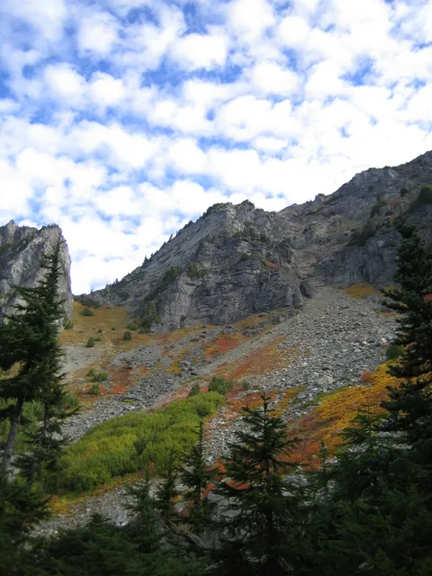
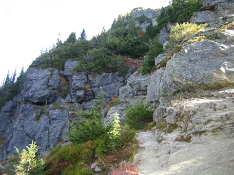
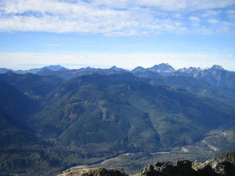
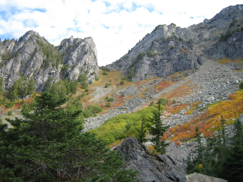
Up until this point, the trail has been traveling in a South-Easterly direction but once past the lake you'll find yourself hiking North East towards Stujack Pass.  At nearly four miles, you'll exit the forest and find yourself amongst boulders facing a long open climb up to Stujack Pass, the large V up above.  We rested here sitting on top of one of the boulders in preparation for the steep climb.  From this vantage point, it is not clear where the trail leads but it will switchback slowly up the slope.  Watch your step on the rocks and keep an eye out for varmits, we saw a few darting in an out of view underneath the rocks.  When we climbed this in the fall, the colors were amazing on this hillside as everything was changing color.  Stujack Pass was our lunch spot, which I estimate somewhere around 5,500ft but am not certain.  Here you'll get a good look at Glacier Peak in one direction and will also be able to look back the way you came then farther towards Monte Cristo and even the faint Olympic Mts which are behind a layer of smog.  Below the other side of Stujack was a small patch of snow, and as we worked our way upward there was a glacier to the left as well. 

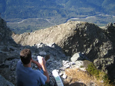
As my hiking book noted, Stujack is probably a good turn around point for the less ambitious or those lacking experience.  Either way, rest up and enjoy the view.  If you decide to continue, take your time and watch what you're doing.  Narrow ledges give way to a knife-back ridge which you must traverse to continue.  Being slightly afraid of heights, I found this quite exhilarating but could imagine problems for people less adventurous.  Thankfully, my hiking partner was quite experienced and had some good pointers.  I probably wouldn't go this far alone as the drop on either side of the ridge would surely kill if not break something important...lesson: hike in pairs or at least let someone know where you're going.  Once passed the long narrow stretch of the ridge you'll see what's left of a winch system used to haul supplies up to the top.  You may miss this at first as we did since the route we took was lower on the North side of the ridge, but there are several places where you can take the high road and see the framework.  Now, you'll be faced with some scrambling which quickly turns into what I'd call climbing.  Despite the desire to reach the top and being so close, I was uncomfortable going much farther on this day as it was too technical and I was in over my head. Overall, this was a fantastic hike which I would definitely return to in the future and perhaps even complete.  The views are very rewarding, the trail is in good condition, there aren't many hikers on this trail, and you get a good variety of terrain...all of which makes for a great day.

Photos 15

Highest rated first
Reviews 5

Fair Game Now

★★★★☆
Hans the Wolf · Jun 27, 2008 · Moderate

The trail is in excellent shape due to WTA efforts. While I would not recommend this for people that cannot bend or stoop, because there is around 20 trees over the trail in various places.

The route is clear to the lake. After that, everything is good until 4500 ft where you loose the trail due to snow. This should be gone by 7/1/2008. At about 5200 ft, there is snow over the open areas, but it is thin and slick. For this, you will still need the ability to self-arrest/ice axe. I did not go past Stujack, however everything above about 5500 ft is clear of snow.

Parking remains severely limited at the trail head and I would recommend carpooling and hiking up.

The view, as always is excellent at about 5200 ft and up, but this is about 5 miles in and after 3,000 ft in elevation gain.

I spoke with a FS ranger at the lake, the valley approach to Dickerman / Forbidden is fairly clear, but there is still significant snow dropping/avalanche into the valley. This should be gone by next weekend.

Mt. Pugh

★★★★★
Bruce Vanderhoff · Jun 4, 2008 · Moderate +

Spectacular scenery from the top on a clear day! Be careful to keep track of the cairns (pile of rocks to mark the trail) at the top as they get smaller, and smaller. Route finding down with a late start in low lighting could be disastrous, or in snow without crampons,or an ice- axe.  Highly recommended hike/climb with an early start, and good weather/ visibility.

★★★★★
Anonymous · Sep 11, 2007 · Strenuous

This one was an adventure. I intended to be hiking by 9:30 AM, but got myself on a wild goose chase looking for the trailhead.  I asked a ranger where to find FR 2095 and he said it was the next left.  I took the next left but that turned out to be an unmarked and badly overgrown logging road.  Had a horrible time finding a place to turn around and scratched up my car pretty bad.  I eventually found the right road but didn’t get hiking until 11:15.

Anyways the hike itself was beautiful. Could not have asked for a better day and the wildflowers were still out by Stujack pass.  Trail was in excellent condition and even the scrambling portion was much more straightforward than I expected. If you are attentive and stay on beaten path you shouldn’t run into anything difficult or scary. Since I had such a late start I wasn’t expecting to make it all the way up but I made the decision that as long as I was below the tree line it would be okay to hike in the dark since the trail was in such good condition. I took 5 hours up, 45 minutes at the top, and 4 hours down.  Some of that time was spent messing with my camera and taking way too many pictures.  It was absolutely breathtaking with the low sun angle on the way down.  Could see the sun glinting off Puget Sound through a gap left of the Three Fingers. Saw a mountain goat walking in the bowl! Wildflowers were still out. The shadows of the mountains were also really cool looking as the sun got lower.

Ended up hiking the last two miles alone in the pitch dark forest with my trusty flashlight (I brought 2 flashlights and two extra sets of batteries). That was an eerie experience.  There are no crickets in Washington forests!  The silence was downright creepy. Every little creek or rustle put me on edge. Don’t laugh. First time I’ve honestly been afraid of the dark since I was a little kid!  I was glad to get back to my car.

July 28 to the top

★★★★★
C Osmun · Jul 28, 2007 · Strenuous

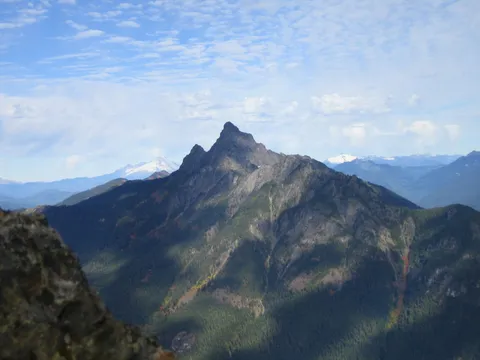
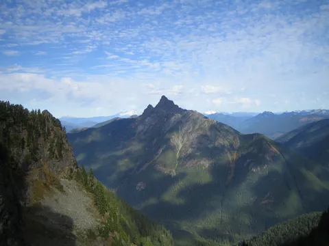
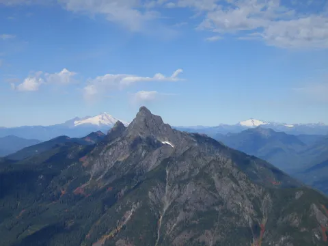
It was a gorgeous day  - blue sky and sunny.  We began at the trailhead at 9 AM.  We lost the trail twice as the switchbacks often look like the trial actually goes straight.  If you start heading into the forest and log climbing, turn back.  It took us 5 hours to the top.  All the above is true with the climb.  There are some places going up near the top where watching the trail closely is important lest you end up on something nearly impossible to traverse.  Remember, switchbacks are key on the whole hike.  If you get to a place you can't cross, it's probably because you're off the trail.  The view at the top is 360 degrees and the most prominent peaks close up are Sloan Peak to the Northeast and White Chuck (the most pointed one within the closest range) to the Southwest.  The clouds were dancing below us.  It was a 9-hour hike for us.  My hiking partner was having some difficulty with going down, so we went very slowly.  Eight hours is doable.  There were 17 other people on the mountain on this day.  Sure beats Mt Si in many ways!!  Way worth the drive.

Awesome

★★★★★
Susan L. · Jun 14, 2007 · Strenuous

This hike was very strenuous, but phenomenal!  It incorporated all of the great aspects of hiking- old growth forest, alpine meadow (wildflowers), rock, a stroll by an actual glacier, and scrambling.   The views from the summit were awesome; I highly recommend this hike (but my legs were sore for a few days)....

Log in or sign up to write a review.